
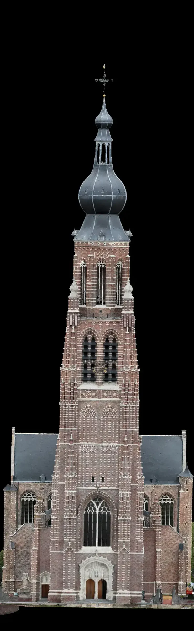
Roof and facade inspection in 3D.
Want to know the condition of your roof and facades, without scaffolding or a cherry picker? We fly around your building and turn it into a measurable 3D model. In it, we mark what we see: a loose tile, a cracked joint, a blocked gutter. You view everything online, check measurements yourself and, on the next visit, see right away what has changed.
Your building,
measurable in 3D.
A visual report is not a structural survey and not an inspection by an engineer or certified inspector. We show what is visible from the air on the day of the flight. What lies under the roof covering, inside the structure or indoors, we cannot see. If you have doubts about safety or stability, have an engineer or specialist look on site.
From flight
to report.
No scaffolding and no cherry picker: the drone does the work from the ground.
- 01
Flight
We fly over and around your building, straight down and at an angle, so the facades are captured too.
- 02
Model and photos
We turn those photos into a 3D model, positioned with RTK and, where needed, ground control points.
- 03
Defects marked
We go through the model and the photos and pin everything that stands out.
- 04
View online
You walk around your building, click a pin, measure for yourself and download the report.
Next visit?
Then you compare.
When you have your building flown again, after a storm, before and after a repair, or simply every year, that flight joins the same timeline. You put two dates side by side and see what changed. That way you build up a record of your building, and you or your contractor plan maintenance based on an accurate picture.
How accurate
is it?
For each project we state the resolution (how many centimetres one pixel covers on the building) and how the model was positioned and checked. So you know how far you can rely on a measurement. For a quote, an area or a slope, that is more than enough. If a dimension has to be exact to the millimetre, for custom work or an order, check it on site.
What clients often ask
Does anyone need to go on the roof?
No. The drone does the work from the ground.
Do you capture the facades too?
Yes, we also photograph at an angle, so the facades are part of the model. Areas behind trees or under a canopy are less visible.
Can I share the model with my contractor?
Yes. You can send a link to a specific view, or ask for extra access for your contractor.
How often should I have it flown?
That is up to you. Many clients choose once a year, plus extra after a storm or a repair.
Do you also make the maintenance plan?
No. We provide the picture, the measurements and the defects. Planning and repairs are up to you and your contractor.
Ready to see your building in 3D?
Tell us which building it is and what you want to know. We will send you a proposal.
Every flight is logged and safety-checked through Airdata UAV: 560+ flights and 2,100+ km, with EU certificates A1/A3 and A2.
View the drone certificate (opens in a new tab)